


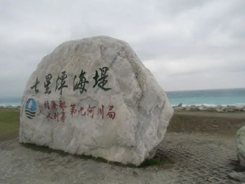
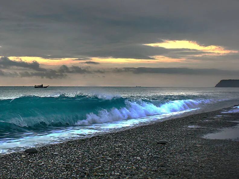
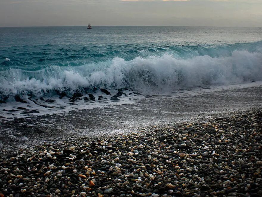
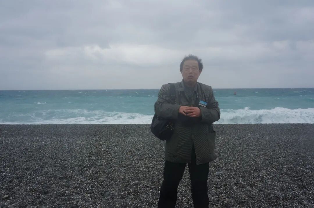
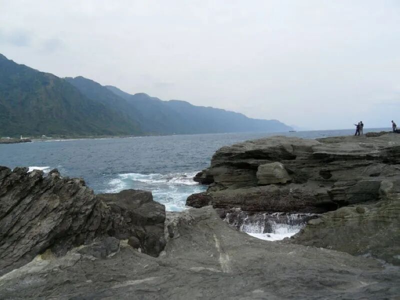
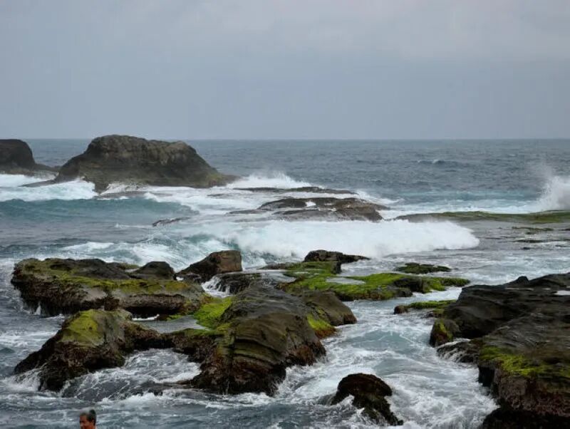
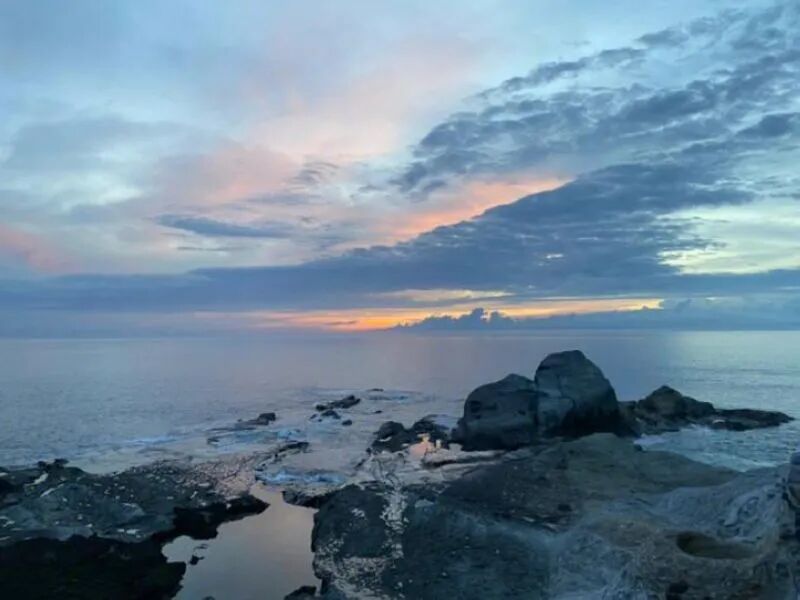
So, you see “Qixingtan” (Seven Stars Lake) in Hualien, Taiwan, and you’re probably thinking, “Oh, a lovely lake!” Plot twist: it’s totally not a lake! It’s actually a stunning, crescent-shaped bay that gracefully juts out from the side of Meilun Mountain. This gorgeous spot, Qixingtan Coastal Park, is nestled just north of the Meilun Industrial Park and east of Hualien Airport. We’re talking about a breathtaking, 12-mile-long, 300-foot-wide arc of coastline, staring straight into the vast, majestic Philippine Sea. It’s Hualien County’s one and only county-level scenic area, extending from the beachfront right into the Qixingtan community, and it’s practically neighbors with Taroko National Park, the East Coast, and the Huadong Valley National Scenic Area. Talk about prime real estate!
Now, for a little history lesson (don’t worry, I’ll keep it fun!). The name “Qixingtan” actually referred to a cluster of small lakes back in the day, right where Hualien Airport stands now. This name first popped up in a Qing Dynasty map, one of the earliest depicting Taiwan’s “back mountain” region. The map showed about seven lakes of varying sizes, hence “Seven Stars Lake.” Fast forward to 1936, and the Japanese decided they needed an airfield in that very spot. So, they filled in most of the lakes and relocated the residents to the current bay area. But get this: even after the move, those folks still proudly called themselves “Qixingtan people.” Loyalty, right?
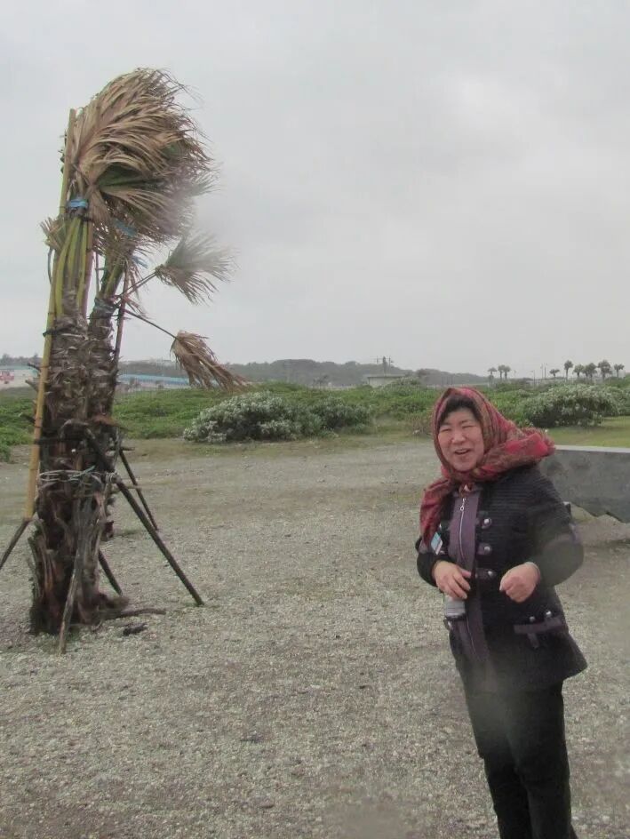
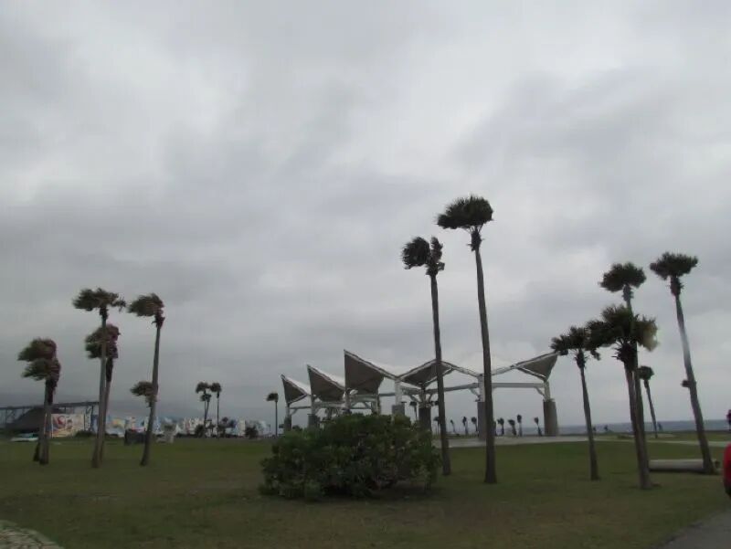
Picture this: a few towering coconut trees are scattered across lush green lawns, instantly giving off those quintessential tropical paradise vibes. The sky was doing its moody thing, all covered in clouds, and the wind? Oh man, it was *really* whipping!
Dotted across the green landscape, there are pathways made of artfully laid stones, leading you straight to the ocean. Along these paths, strategically placed boulders invite you to take a load off and just soak it all in. Closer to the shore, you’ll spot this incredible stone sailboat – just two long rocks, one horizontal, one vertical, pieced together. But standing there, it totally embodies that “ready to conquer the waves” spirit, truly amazing!
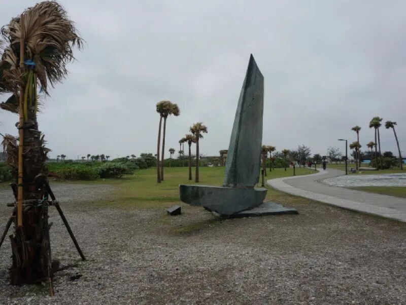
Then there’s the sail-shaped “Sunrise Pavilion,” a real icon of this coastline. Its sleek, triangular design is so dynamic and soaring, it practically makes you feel the sea breeze hitting your face just by looking at it!
To the west of the coast, you’ve got the magnificent Central Mountain Range, rolling and stretching across the entire island from north to south. It’s often called the “backbone of Taiwan,” and these continuous peaks literally split the island into two asymmetrical halves: a wider, gentler west, and a narrow, dramatically steep east. The Central Mountain Range gets a ton of rain year-round, making it the source of countless rivers across Taiwan, and it’s just overflowing with lush forests and dense vegetation.
Because of its natural wonders and unique history, Eastern Taiwan was the last region on the island to really get developed. That means it’s still more pristine, more natural, and home to the majority of Taiwan’s indigenous communities, especially in areas like Taroko. And that’s exactly why folks who are totally over the noise and grime of big cities flock here. They’re all looking for a slice of paradise, a place to truly unwind and recharge their tired minds and bodies. With its incredible mountains and crystal-clear waters, Eastern Taiwan has become that rare, perfect escape.
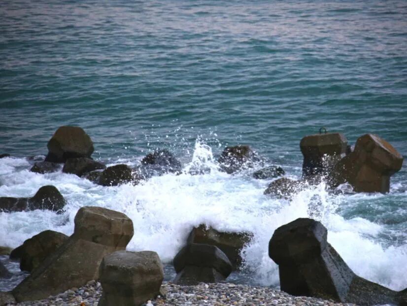
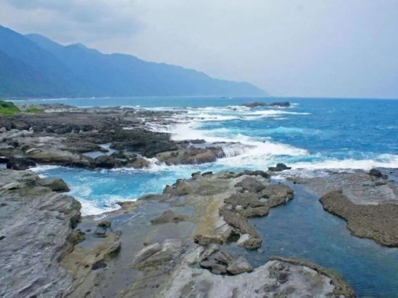
To the east of Qixingtan lies a vibrant, boundless part of the Philippine Sea. This crescent-shaped bay is just sparkling clean, a true testament to Hualien County’s awesome commitment to environmental protection. Major props!
Along the Qixingtan coast, there’s a sweet bike path that hugs the bay. You’ll often see tons of cycling enthusiasts out there, getting their workout in, soaking up the views, and breathing in that glorious fresh air.
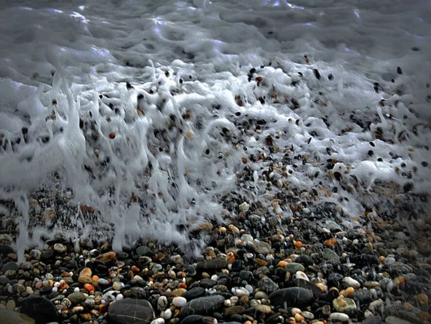
And forget fine sand here, folks! The entire beach is covered in all sorts of smooth pebbles and rocks. It’s an absolute rock-picker’s paradise, but remember the golden rule: admire ’em all you want, but please put ’em back for the ocean to keep!
Qixingtan truly is a shining gem on Taiwan’s East Coast – maybe not the biggest, but undeniably dazzling. The wind was so gnarly, we only managed a whirlwind fifteen-minute stop! (Okay, fine, it was more like twenty, but still!)
Around 3:30 PM, we rolled into Shitiping.
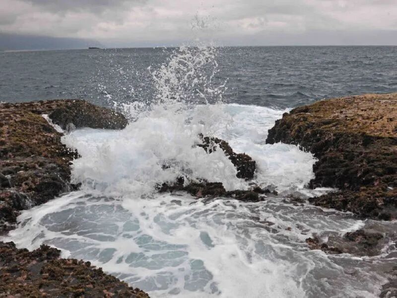
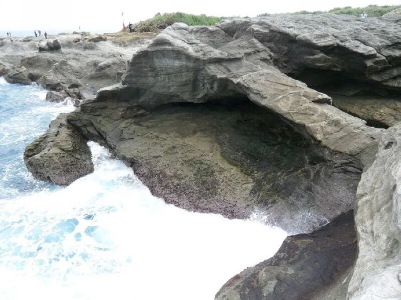
Shitiping is located in Gangkou Village, Fengbin Township, Hualien County, on Taiwan’s eastern side. This recreation area is a mile-long stretch of wild, almost alien landscape, covered in unique gray-white rock formations. It’s actually a tuff (volcanic ash rock) formation that resulted from an ancient volcanic eruption. Over countless years, the ocean’s relentless carving has sculpted these rocks, eroding the softer layers and leaving the harder ones to protrude. Plus, with the rock layers tilting towards the southeast sea at a specific angle, you get these incredible, stair-like “Shitiping” formations. Nature’s architects, right?
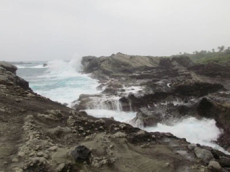
Because of this incredible process, Shitiping is renowned for its unique geology. The entire geological cross-section here is about 300 feet deep: at the bottom, you’ve got about 100 feet of andesite lava (a type of neutral volcanic rock), then it’s covered by white tuff and volcanic breccia, all topped off with looser, grayish-white tuff. It’s like a natural history book etched in stone, right before your eyes!
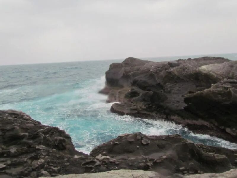
Follow the stone pathways, and you can get up close and personal with all sorts of cool geological features: sea-eroded grooves, towering cliffs, expansive sea platforms, and even uplifted coral reefs. Seriously cool stuff for any geology enthusiast (or just someone who appreciates a good view!).
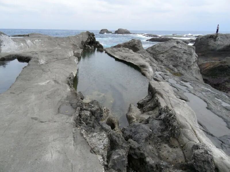
Along the Shitiping coastline, you’ll find unique, strangely shaped rocks everywhere. The uplifted coral reefs are dotted with countless round holes – perfect little hideaways for crabs and tropical fish to chill and swim!
Thanks to the constant pounding of the waves, the sea-eroded rock platforms are riddled with potholes, varying in size and depth. Some even have smooth, rolling pebbles inside, and a few actually protrude from the ground, looking just like giant bathtubs. How cool is that?

You’ll also spot a variety of hardy coastal plants thriving on the rock platforms around Shitiping, like cacti and beach morning glory. They grow in charming clusters, adding a touch of green beauty to the dramatic scenery.
Standing on Shitiping’s rugged, rock-strewn coast, gazing out at the boundless, deep blue Pacific Ocean, watching the waves surge, crash, and send spray flying – it’s truly a heart-soothing, breathtaking experience. Instant zen!

We spent a solid hour soaking it all in at Shitiping.
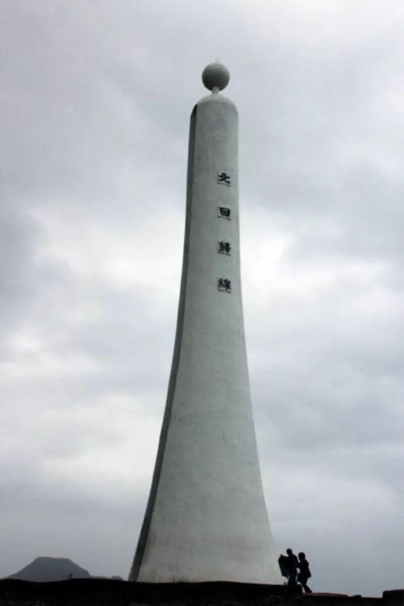
Next up, the Tropic of Cancer Monument! This landmark, located in Shueilishang Township, Chiayi County, was originally built way back in 1908 during the Qing Dynasty. It got a little dinged up during the big Chiayi-Nantou earthquake in 1964, but they fixed it right up to what you see today. Honestly, it’s just a cool geographical marker – don’t expect any gift shops or fancy tourist amenities. Just a spot to stand on a significant line of latitude!
So, we kicked off our day at 7 AM and finally rolled into our hotel at 7:30 PM. Let’s break down the “sightseeing”: 50 minutes at Shakadang Trail, 15 minutes at Qixingtan (seriously?!), 35 minutes at Shitiping, an hour for shopping (priorities!), and 50 minutes for food. That’s a whopping nine hours of driving for such short stops! Was it worth it? The jury’s still out on that epic road trip!
More Stories
Yilan Ranch: Where Taiwan’s Cutest Critters and Family Fun Collide!
Yilan: Your Epic Escape to Taipei’s Backyard Playground! (Lanyang Museum & Must-Try Taro Ice Cream)
Taitung’s Chishang: Where Pure Oxygen Meets Golden Rice Fields (And Epic Eats!)